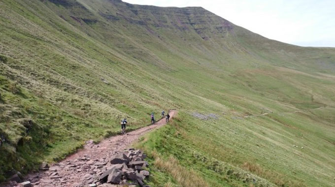
Brecon Beacons
The Breacon Beacons is a much loved area for mountain biking. There are around 16 designated natural trails on offer which all start from a number of mountain biking hubs and are graded from green to black. The reason why we love them so much is that they are not purpose built and therefore offer a more natural experience. There is also a great bike bus that offers pick up and drop off from several locations.
Hubs & Trails
Brecon – From the town of Brecon, just North of the Brecon Beacons themselves, you can enjoy three routes as well as many bike shops, places to eat and places to stay in the town.
Visitor Centre Route – 8km – An easy route suitable from beginners and families.
Mynydd Illtud – Blue – 24km – Quite a challenging route but it does offer the possibility of shortcuts if needed. It takes you from Brecon up to Cefn Llechid where you will be rewarded with amazing views and a descent down open hillside, farm tracks and country lanes before a short climb back to the centre.
The Gap – Red – 38km – One of the classic trails in the Beacons it follows the Taff Trail, Brinore Tramway and the Gap road. Rideable in all weathers but it can get a bit difficult in bad weather. It has a tricky ravine halfway up the Gap road and a few large rock steps at the beginning of the descent from the Gap itself. The descent goes from the top of the Brinore Tramway to the valley bottom, just upstream of the Talybont Reservoir. The track varies from smooth grass, to gravel, rocks and ruts.
Crickhowell – A small town in Powys, Mid Wales with a number of pubs, cafes, restaurants and hotels. A good starting point to explore what the Beacons have to offer.
Crickhowell Loop – Blue – 16km – This loop allows you to do most of the climbing on tarmac leaving all the descents to natural singletrack and off road paths.
Sennybridge – A great hub to start from, Sennybridge has a range of accommodation and facilities if you are making a weekend of it.
Usk Reservoir – Green – 8.9km – This route is a circuit of Usk Reservoir, most of the climbing will be done on forest roads and tarmac. The start takes you to the water’s edge before climbing back on the road.
Cwm Treweryn – Blue – 14.5km – This blue route has an optional extra loop half way round. With a 200m descent, it loops back to Sennybridge.
Sarn Helen – Red – 33.8km – This trail starts off on country lanes before joining the Sarn Helen road. It then brings you down a tarmac descent and runs along the Senni Valley before climbing 150m again. The final stretch is along Heol Cefn Y Gaer, passing the site of one of the many hill forts in the Brecon Beacons National Park.
Talgarth – Situated to the North East of Brecon, as well as mountain biking there are a whole host of other outdoor activities to be enjoyed here.
Llangors & Bwlch – 38.6km – The first half of this route is mostly off-road then from Cwm Siencyn you climb to the top of Cefn Moel before going down to the village of Bwlch. From Bwlch you go up to the knife edged ridge of Allt yr Esgair and the Iron Age hill fort, before descending again, now on a narrow path, to Pennorth back to Talgarth.
Grwyne Fawr Reservoir – Black – 51.5km – This route reaches heights of around 700m. It is very open and takes you out of Talgarth to the top of Y Dâs. At the top you descend past Grwyne Fawr Reservoir and down to Mynydd Du Forest. You then make your way through the forest and along country lanes. There is a very steep descent past the church at Ffynon Ishow then a climb back up to the “cairn” at the ridge top at Pen Trumau. The descent to Talgarth takes you along lanes and tracks with one last climb to the base of Castell Dinas. It can also be ridden in reverse.
Talybont on Usk – Both the Taff Trail and the Monmouthshire and Brecon canal pass through Talybont-on-Usk and three routes go from this point. Car Parking is available at Henderson Hall, Penpentre, and it’s great if you intend to leave your car all day. There are also pubs, cafés and a range of accommodation in the town.
Tramway – Green – 8.9km – This trail follows the Taff Trail climbing up on a forest road before returning to the Brinore Tramway then descending to Talybont.
Talybont Forest – Blue – 17.7km – Again this trail takes you on the Taff Trail up from Talybont. The Brinore Tramway then takes you a short way up into the forest before a descent to the Talybont Reservoir. You then cross to the other side of the valley for some hilly riding in Talybont forest. A rewarding trail with some fun descents.
Pontsticill Crossover – Red – 33.8km – The Pontsticill trail is a figure of eight loop that starts with a 400m climb before descending to the half-way point of Pontsticill village. After the village you can choose between the Taff Trail forest route or the road alongside Pontsticill Reservoir, before going off-road and up to the figure of eight crossing and down to the Usk Valley just a few kilometres down the road from Talybont.
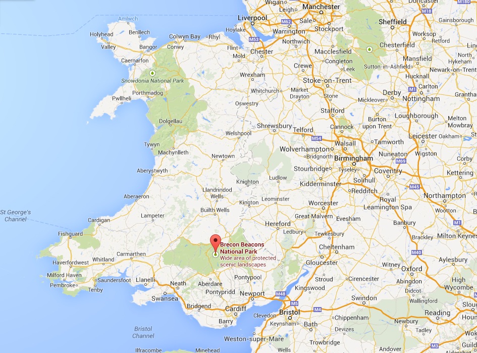
If you don’t know where the Brecon Beacons are then wonder no more…
